MEA icons for : SDG and Aichi targets
Shapefiles to be used for the GIS training facilitated by EMG for all staff.
Dates : 8 - 9 November 2021
to be deleted
This dataset has all icons for Multilateral Environment Agreements such as SDGs and Aichi
Documentation on getting started with the Inform Data Portal
State of Environment (SoE) reports provide in-country partners with a process to gather data on current environmental indicators, document their status, and formulate a plan for keeping these indicators on track or developing policies and programs as needed. This SoE Toolkit dataset contains resources that serve as guides to help create up-to-date State of Environment reports.
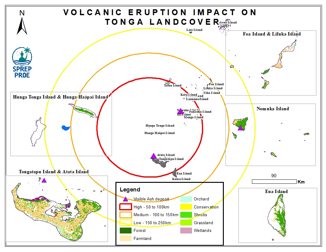
This dataset contains all spatial data that is related to the Tonga volcanic eruption. Maps produced are derived from credible data source such as UNOSTAT and UNITAR.
