This dataset contains the raw data collected for the Tonga waste audit undertaken by APWC conducted on Tongatapu, Vava'u and Ha'apai funded by the World Bank
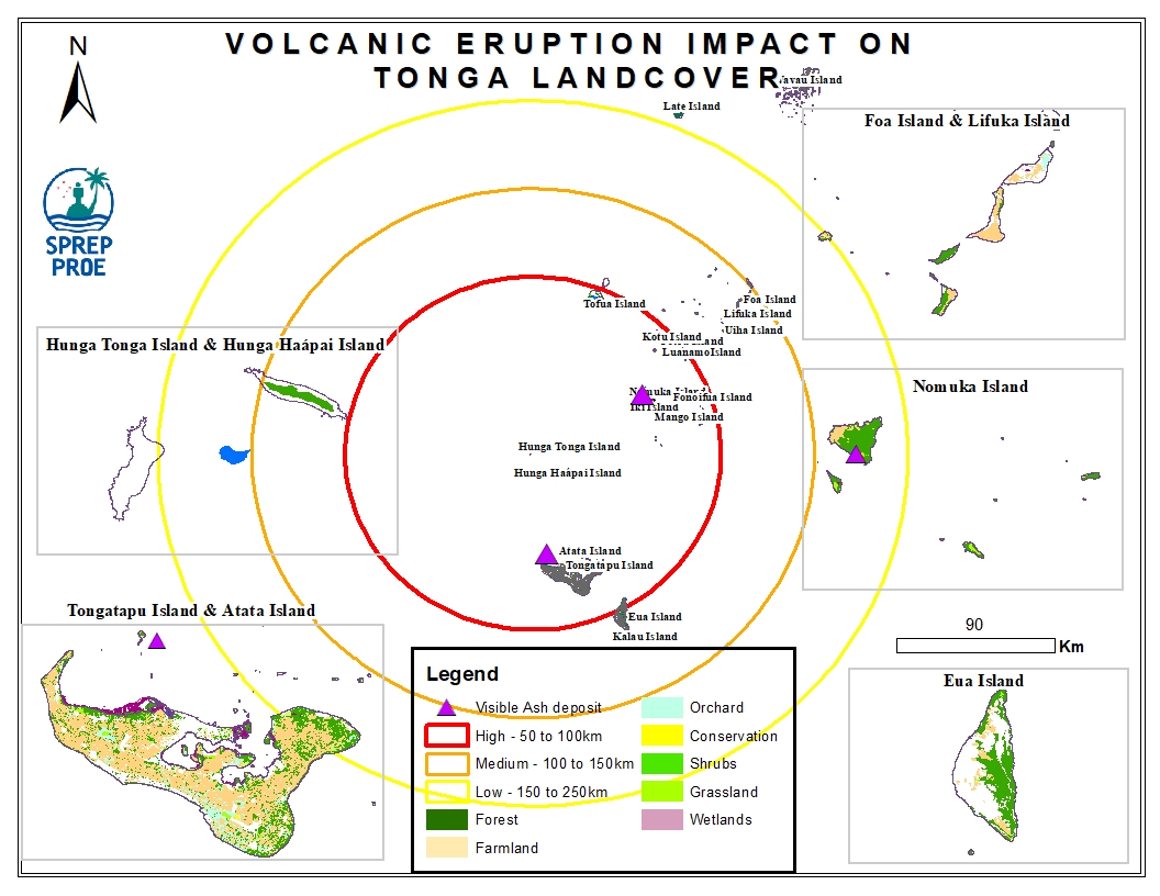
The Hunga Tonga-Hunga Ha'apai massive undersea volcanic eruption occurred on the 15th of January 2022 and led to an induced tsunami event. The eruption triggered a tsunami warning for several South Pacific island nations with rising water levels were reported on the coastline of Peru and the Pacific Coast in the United States and caused devastating impact across Tonga. In addition, volcanic ash residue was also visible on land surfaces including building structures and surrounding vegetation.
This dataset contains preliminary impact assessments of the Hunga-Tonga-Hunga-Ha'apai volcanic eruption and induced tsunami in January 2022.
The eruptions sent a plume of ash, gas and steam 20 kilometers (12.4 miles) into the air. Satellite imagery showed a massive ash cloud and shockwaves spreading from the eruption. Ash was falling from the sky in the Tonga capital, Nuku'alofa, Saturday evening and phone connections were down. The eruption was likely the biggest recorded anywhere on the planet in more than 30 years, according to experts.
This dataset contains all spatial data that is related to the Tonga volcanic eruption. Maps produced are derived from credible data source such as UNOSTAT and UNITAR.

This publication intends to assist project designers, regulators and decision makers to anticipate and address all relevant public health, socio‐economic and environmental concerns that may arise when under‐ taking a desalination project, for obtaining maximum beneficial use of the desalinated water in terms of quality, safety and environmental protection.
Case study from Kiribati is linked at the bottom of this dataset
Tonga fleet longline catch for tuna and other species. Source: Fisheries Department.
Documentation on getting started with the Inform Data Portal
Shapefiles to be used for the GIS training facilitated by EMG for all staff.
Dates : 8 - 9 November 2021
to be deleted
Summary data of tonga agriculture exports. Source: Agriculture Division.
Data on the consumption of petroleum products within each sector. Source: Energy Sector.
Snapper fishery catch data by species 2013-2017. Source: Fisheries Division.
Inshore fishery catch data by region and fish family. Source: Fisheries Division.
MEA icons for : SDG and Aichi targets
Marine pollution in the Pacific. Regional data
Dataset that provides a direct link to Tonga's data hosted on the GBIF website/ records.
Draft word document of the Tonga SoE 2010 report