Environmental conditions and anthropogenic impacts are key influences on ecological processes and associated ecosystem services. Effective management of Tonga’s marine ecosystems therefore depends on accurate and up-to-date knowledge of environmental and anthropogenic variables. Although many types of environmental and anthropogenic data are now available in global layers, they are often inaccessible to end users, particularly in developing countries with limited accessibility and analytical training.
MACBIO is a project that supports sustainable economies and livelihoods of Pacific Island Countries by strengthening institutional and individual capacity, to manage and conserve biodiversity in marine and coastal ecosystems. The project was commissioned by BMUB to GIZ as part of IKI, jointly implemented by SPREP, IUCN and GIZ from 2013 to 2018.
This dataset holds all MACBIO-related resources pertaining to Tonga as one of the participating countries.
The World Database on Protected Areas (WDPA) is the most comprehensive global database of marine and terrestrial protected areas, updated on a monthly basis, and is one of the key global biodiversity data sets being widely used by scientists, businesses, governments, International secretariats and others to inform planning, policy decisions and management. The WDPA is a joint project between UN Environment and the International Union for Conservation of Nature (IUCN).
Guidelines, brochures, Indicators and published work on the Cartagena Protocol on Biosafety to the Convention on Biological Diversity which is an international treaty governing the movements of living modified organisms (LMOs) resulting from modern biotechnology from one country to another.
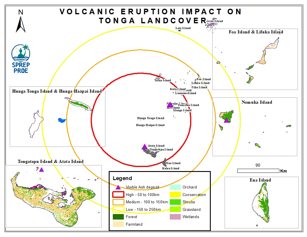
This dataset contains all spatial data that is related to the Tonga volcanic eruption. Maps produced are derived from credible data source such as UNOSTAT and UNITAR.
