Environmental conditions and anthropogenic impacts are key influences on ecological processes and associated ecosystem services. Effective management of Tonga’s marine ecosystems therefore depends on accurate and up-to-date knowledge of environmental and anthropogenic variables. Although many types of environmental and anthropogenic data are now available in global layers, they are often inaccessible to end users, particularly in developing countries with limited accessibility and analytical training.
MEA icons for : SDG and Aichi targets
Shapefiles to be used for the GIS training facilitated by EMG for all staff.
Dates : 8 - 9 November 2021
to be deleted
This dataset has all icons for Multilateral Environment Agreements such as SDGs and Aichi
Documentation on getting started with the Inform Data Portal
This list of indicators was developed through the Inform project at SPREP for use by Pacific Islands countries (PICs) to meet their national and international reporting obligations. The indicators are typically adopted by PICs for their State of Environment reports and are intended to be re-used for a range of MEA and SDG reporting targets. The indicators have been designed to be measurable and repeatable so that countries can track key aspect of environmental health over time.
State of Environment (SoE) reports provide in-country partners with a process to gather data on current environmental indicators, document their status, and formulate a plan for keeping these indicators on track or developing policies and programs as needed. This SoE Toolkit dataset contains resources that serve as guides to help create up-to-date State of Environment reports.
Provides principles to support nature conservation in pacific islands
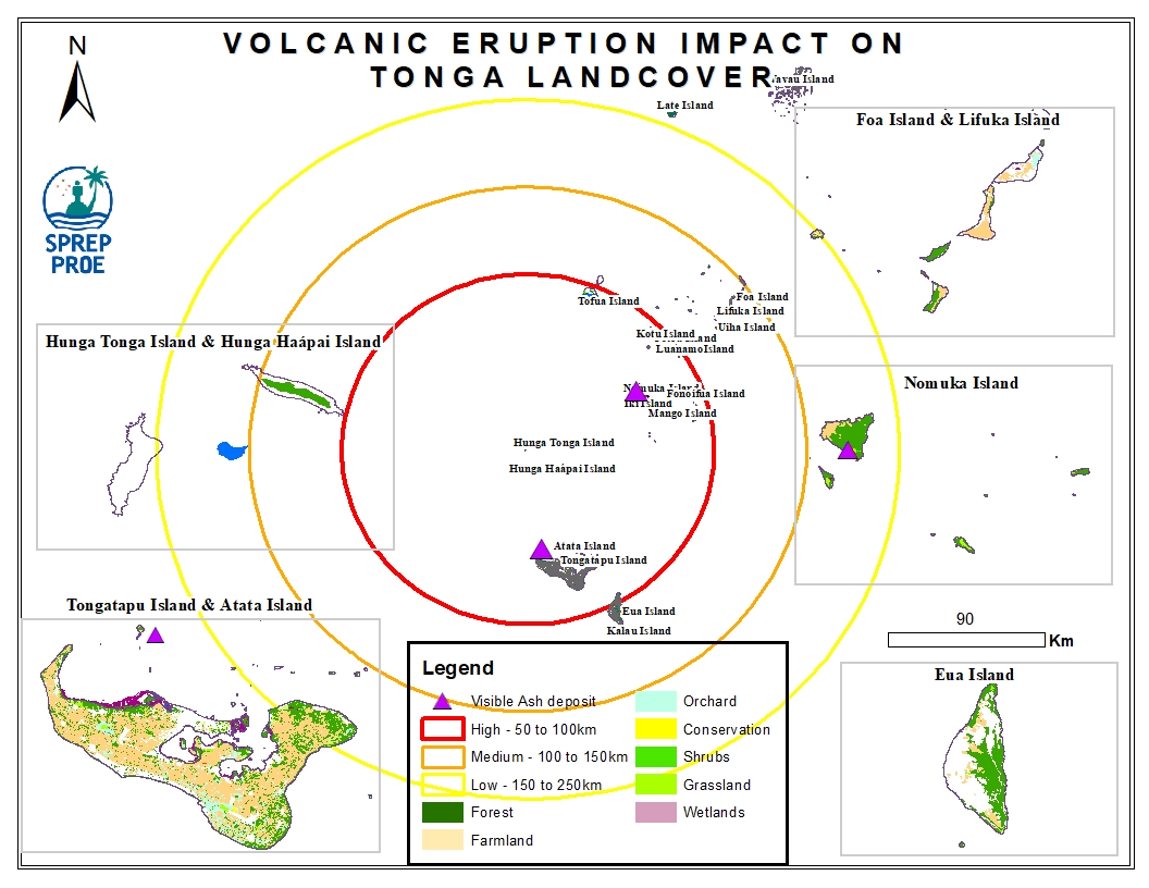
This dataset contains all spatial data that is related to the Tonga volcanic eruption. Maps produced are derived from credible data source such as UNOSTAT and UNITAR.
