raw rainfall data collected in 2016
MODIS (or Moderate Resolution Imaging Spectroradiometer) is a key instrument aboard the Terra (originally known as EOS AM-1) and Aqua (originally known as EOS PM-1) satellites. Terra's orbit around the Earth is timed so that it passes from north to south across the equator in the morning, while Aqua passes south to north over the equator in the afternoon. Terra MODIS and Aqua MODIS are viewing the entire Earth's surface every 1 to 2 days, acquiring data in 36 spectral bands, or groups of wavelengths (see MODIS Technical Specifications).
MEA icons for : SDG and Aichi targets
This dataset holds all media resources for the State of Environment and Conservation in the Pacific Islands: 2020 Regional Report
This dataset has all icons for Multilateral Environment Agreements such as SDGs and Aichi
Documentation on getting started with the Inform Data Portal
Tropical Cyclone Gita hit the main island of Tongatapu and the island of ‘Eua on the night of Monday, 12th February 2018 as a destructive category 4 storm, causing severe damages to these two islands which consists of about 80% of the Total population of Tonga.
This assessment uses the post-disaster data collected by the Statistical Department to describe the characteristics of the affected population, nature and spatial concentration of the damage, and the aid required and received at the time of the interview by the Tongan population.
Resources for the SPREP Inform workshop in Samoa
This list of indicators was developed through the Inform project at SPREP for use by Pacific Islands countries (PICs) to meet their national and international reporting obligations. The indicators are typically adopted by PICs for their State of Environment reports and are intended to be re-used for a range of MEA and SDG reporting targets. The indicators have been designed to be measurable and repeatable so that countries can track key aspect of environmental health over time.
State of Environment (SoE) reports provide in-country partners with a process to gather data on current environmental indicators, document their status, and formulate a plan for keeping these indicators on track or developing policies and programs as needed. This SoE Toolkit dataset contains resources that serve as guides to help create up-to-date State of Environment reports.
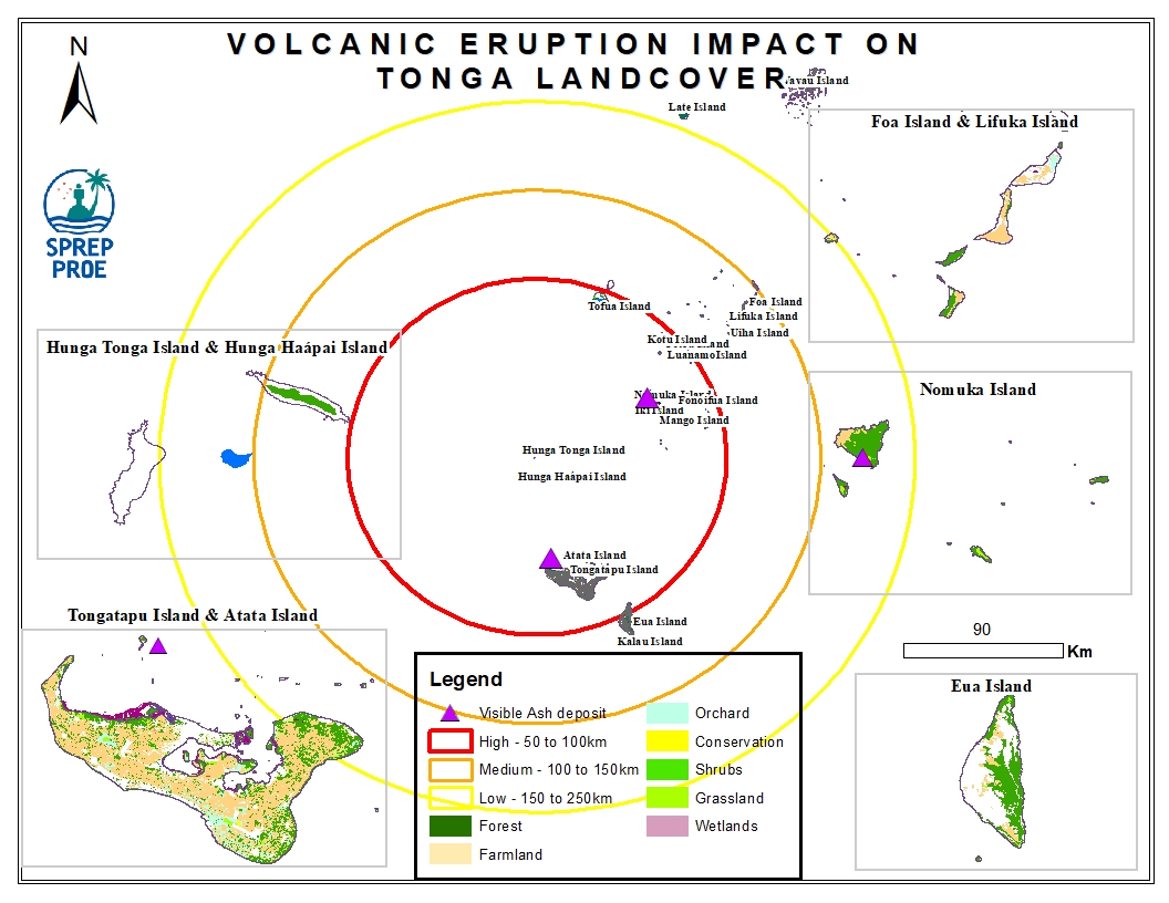
This dataset contains all spatial data that is related to the Tonga volcanic eruption. Maps produced are derived from credible data source such as UNOSTAT and UNITAR.
