GEBCO's aim is to provide the most authoritative publicly-available bathymetry of the world's oceans. It operates under the joint auspices of the International Hydrographic Organization(IHO) and the Intergovernmental Oceanographic Commission (IOC) (of UNESCO).
GEBCO produces and makes available a range of bathymetric data sets and products. This includes a global bathymetric grid; gazetteer of undersea feature names, a Web Map Service and printable maps of ocean bathymetry.
This project has developed sub-regional bioregionalisations for the western-south Pacific Ocean, through expert workshops and novel statistical analysis of physical and biological data. This combines approaches CSIRO developed in Australia, used in the Bay of Bengal (in collaboration with BOBLME) with similar approaches that have been used throughout the Indian and Pacific Oceans to derive a single combined bioregionalisation.
State of Environment (SoE) reports provide in-country partners with a process to gather data on current environmental indicators, document their status, and formulate a plan for keeping these indicators on track or developing policies and programs as needed. This SoE Toolkit dataset contains resources that serve as guides to help create up-to-date State of Environment reports.
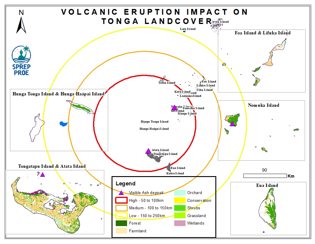
This dataset contains all spatial data that is related to the Tonga volcanic eruption. Maps produced are derived from credible data source such as UNOSTAT and UNITAR.
